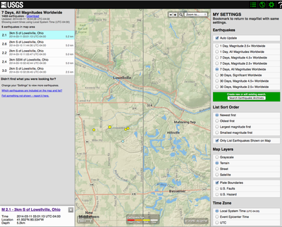
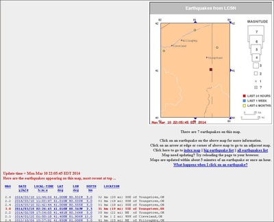
Listing of 12 tremors in this pdf from VIEW LIST (from March 13, 2014, Won-Young Kim, Lamont-Doherty Cooperative Seismographic Network (LCSN), Lamont-Doherty Earth Observatory of Columbia University)
http://www.ldeo.columbia.edu/LCSN/recenteqs/Maps/81-41.html
http://tinyurl.com/5th-earthquake
https://goo.gl/maps/YWNTm
Local media coverage
Youngstown, OH
http://www.vindy.com/news/2014/mar/11/by-tom-mcparland/?fracking
http://www.vindy.com/news/2014/mar/10/update-no-damge-local-quake-was-felt-boardman-and-/
http://www.vindy.com/news/2014/mar/10/breaking-news-odnr-halts-shale-drilling-lowellvill/
http://businessjournaldaily.com/drilling-down/drilling-halted-after-quakes-near-hilcorp-wells-2014-3-11
http://businessjournaldaily.com/drilling-down/us-places-earthquake-epicenter-near-landfill-wells-2014-3-10
http://businessjournaldaily.com/drilling-down/hilcorp-responds-two-earthquakes-near-its-wells-2014-3-10
VIDEO http://businessjournaldaily.com/recent-buzz/ Daily Buzz of Monday, March 10, 2014
http://www.wfmj.com/story/24947731/fifth-earthquake-re
http://wkbn.com/2014/03/10/small-earthquake-recorded/
http://wkbn.com/2014/03/11/landfills-built-to-withstand-earthquake-tremors/
http://www.nofrackingway.us/2014/03/10/ohios-first-frackquake/
______________________
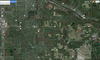
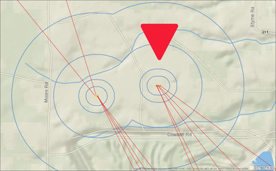
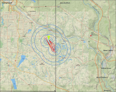
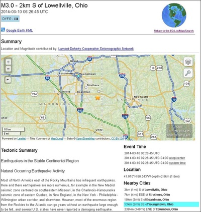
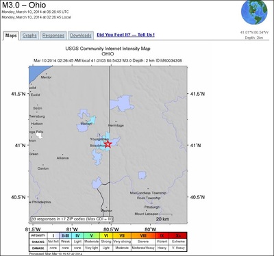
3.0 Frackquake co-ordinates = 41.010°N 80.543°W
SOURCE: http://earthquake.usgs.gov/earthquakes/eventpage/ld60034308#summary
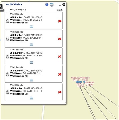
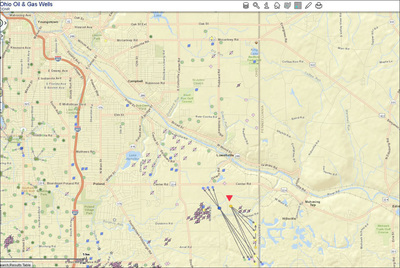
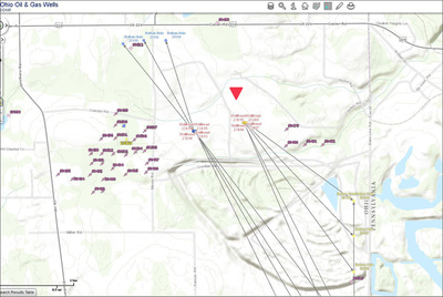
Hilcorp Carbon Limestone CCL 2 5H Well co-ordinates =41.01 - 80.54
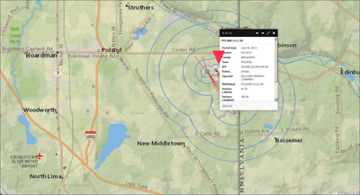
> POLAND CLL2 5H
Permit Date July 16, 2013
Quarter Q3-2013
County MAHONING
Town POLAND
API 34,099,232,000,000.00
Status Drilled
Operator HILCORP ENERGY COMPANY
Well Name POLAND CLL2 5H
Surface Latitude 41.01
Surface Longitude -80.54
Endpoint Latitude 40.99
Endpoint Longitude -80.
SOURCE: http://maps.fractracker.org/latest/?webmap=4e21676b1c00414ba14edf654c7f7fe3
______________________
STUDIES:
1) BCOC study proving _fracking_ causes quakes:
http://www.bcogc.ca/sites/default/files/documentation/information-bulletins/ib2020122003report20released20on20seismic20activity20in20the20horn20river20basin.pdf
2) The Oklahoma Geo Survey study, again, showing _fracking_ quakes (not to be confused with the studies showing injection wells caused most of the Oklahoma quakes - 2 separate things!):
http://www.gwpc.org/sites/default/files/event-sessions/Holland_AustinFINAL.pdf
http://bit.ly/1nET9qE
3) The _British_ Geo Survey study showing _fracking_ caused the Blackpool, UK quakes:
http://earthquakes.bgs.ac.uk/research/earthquake_hazard_shale_gas.html
====== =====
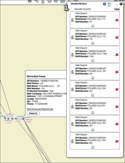
Hilcorp drilling, fracking and general well records for these 2 pads of wells
LOST HOLE: https://gis.ohiodnr.gov/Website/DOG/WellSummaryCard.asp?api=34099231850100
V1 https://gis.ohiodnr.gov/Website/DOG/WellSummaryCard.asp?api=34099231850000
1AH PRODUCING: https://gis.ohiodnr.gov/Website/DOG/WellSummaryCard.asp?api=34099231850200
2-3H COMPLETION: http://www.dnr.state.oh.us/mineral/oil/MRMImages/18/5/263777.pdf
2- 1H COMPLETION: http://www.dnr.state.oh.us/mineral/oil/MRMImages/18/5/263776.pdf
2-2H COMPLETION: http://www.dnr.state.oh.us/mineral/oil/MRMImages/18/5/263778.pdf
2-5H COMPLETION: http://www.dnr.state.oh.us/mineral/oil/MRMImages/18/5/263775.pdf
2-6H COMPLETION: http://www.dnr.state.oh.us/mineral/oil/MRMImages/18/5/263773.pdf
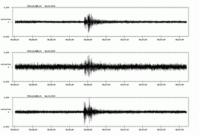
| March 13, 2014 Won-Young Kim, Lamont-Doherty Cooperative Seismographic Network (LCSN) Lamont-Doherty Earth Observatory of Columbia University |


 RSS Feed
